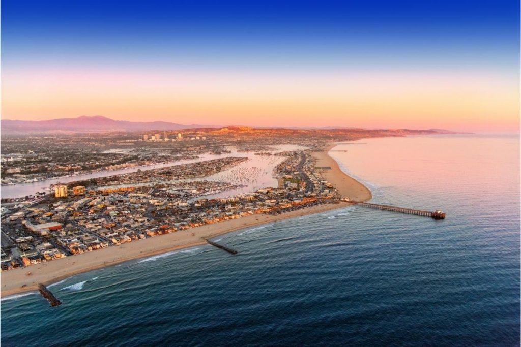
One of the easiest ways to see more of Newport Beach is by running around it. We’ve gone through Newport Beach running trails and analyzed them to assist you in finding the most picturesque spots to run. We’re delighted to show you the Top 9 Best Running Trails in Newport Beach, CA.
Newport Beach Running Trails
The Newport Beach running trails are fantastic spots with beautiful scenery and beautiful sunsets. On these trails, visitors may hike, watch birds, exercise, ride a horse, take beautiful photographs, swim, and windsurf. You will be rewarded with spectacular vistas and unforgettable experiences once you arrive at these California running trails.
Back Bay to Eastbluff
General description
This 4.8-mile Newport Beach running trail is located close to Costa Mesa, California. It typically takes 1 hour and 30 minutes to finish Back Bay to Eastbluff. You’ll probably come into other folks while exploring because this location is popular for road biking and bird watching.
Level of Difficulty
Easy
Length
4.8 miles
Number of steps
Average walk (3mph): 10 810
Average run (6mph): 8 026
Estimated Duration
1h 30min
Getting There
Official Website
Route Type
Out & back
Elevation gain
42 m
Terrain/ Surface
Wide and smooth paved asphalt path
Map of the Trail
Amenities
Kid stroller and wheelchair friendly
Dogs allowed on leash
Other Activities/ Features
Road biking, bird watching
Opportunities for Scenic Stops
Views out to the bay
Weather Forecast
Newport Back Bay Loop
General Description
This is an amazing place to run, ideal for both amateur runners and experienced athletes. The beginning of the trail is level, while the middle is a little bit high. The last part of Newport Back Bay Loop is sloppy. This journey is like a circle; you will see a few parks as you run through.
Level of Difficulty
Easy
Length
11.4 miles
Number of steps
Average walk (3mph): 25 673
Average run (6mph): 19 061
Estimated Duration
3 h 44min
Getting There
Official Website
Route Type
Loop
Elevation gain
148 m
Terrain/ Surface
Partially paved
Map of the Trail
Amenities
Free street parking, multiple entry points, kid-friendly
Other Activities/ Features
Mountain biking, walking, bird watching, hiking trail
Opportunities for Scenic Stops
Scenic stops at places like Upper Castaways Park, the County of Orange’s Peter and Mary Muth Interpretive Center, the new Back Bay Science Center at Shellmaker Island, and Big Canyon
Weather Forecast
Bolsa Chica State Beach Path
General Description
Bolsa Chica State Park boasts of some of Southern California’s most breathtaking sunsets. This park offers amazing activities like hiking, boating, bicycling, swimming, and windsurfing. While at Bolsa Chica State Beach Path, keep an eye out for migratory shorebirds at the park.
Level of Difficulty
Easy
Length
5.7 miles
Number of steps
Average walk (3mph): 12 836
Average run (6mph): 9 530
Estimated Duration
1h 40min
Opening time
Open year-round
Getting There
Official Website
Bolsa Chica State Beach Path Website
Route Type
Out & back
Elevation gain
18 m
Terrain/ Surface
Paved asphalt, 3 to 7 feet wide
Map of the Trail
Amenities
Stroller and wheelchair friendly
Benches, picnic tables, and bathrooms
Other Activities/ Features
Migrating shorebirds watching (You may spot ducks, geese, sandpipers, terns, gulls, swans, and cormorants)
Biking, swimming, fishing, boating, windsurfing, surfing, hiking
Opportunities for Scenic Stops
Path along the ocean shore with beach access. Spectacular sunsets
Weather Forecast
Mariposa and Canyon Loop
General Description
It takes 52 minutes on average to finish this Newport Beach running trail, which is typically considered slightly tricky. Although Mariposa and Canyon Loop is used frequently for jogging, hiking, and bird watching, you may still find some peace and quiet during the slower periods of the day.
Level of Difficulty
Moderate
Length
1.9 mile
Number of steps
Average walk (3mph): 4 279
Average run (6mph): 3 177
Estimated Duration
52min
Opening time
Open year-round
Getting There
Route Type
Loop
Elevation gain
93 m
Terrain/ Surface
Rocky
Map of the Trail
Amenities
Paid parking
Other Activities/ Features
Walking, bird watching, forest, lake, wildlife, hiking
Opportunities for Scenic Stops
Beautiful scenery. Meadow & top of ridge, gorgeous lake
Weather Forecast
Capistrano Beach – Patriot Trail and Cerro Rebal Trail Loop
General Description
This Newport Beach running trail is divided into three sections with different challenges. After the first section, you’ll enjoy the Pacific Ocean view. There is a little downhill incline on the second part of the walk before arriving at the pathway’s end. The third section of this 3.5-mile trail will show you the 360 ° view of the shore. While traveling, you may see dolphins, whales, sea otters, and many more.
Level of Difficulty
Moderate
Length
3.5 miles
Number of steps
Average walk (3mph): 8 107
Average run (6mph): 6 019
Estimated Duration
1h 32min
Opening time
Open year-round
Getting There
Route Type
Out & back
Elevation gain
147 m
Terrain/ Surface
Steep hill
Map of the Trail
Amenities
Kid-friendly, Dogs on leashes are allowed
Other Activities/ Features
Walking, bird watching, mountain biking, hiking
Opportunities for Scenic Stops
Gorgeous views at the flag pole. Scenic coastal views
Weather Forecast
Some More Newport Beach Running Trails
Dana Point Harbor Trail
General Description
Typically seen as a simple path, Dana Point Harbor trail is one of the most liked running trails in Orange County. Even while this trail is well-liked for jogging and paddle sports, you may still find some peace on it during more sedate times of the day.
Level of Difficulty
Easy
Length
1.9 mile
Number of steps
Average walk (3mph): 4 279
Average run (6mph): 3 177
Estimated Duration
33min
Opening time
Open year-round
Getting There
Official Website
Dana Point Harbor Trail Website
Route Type
Loop
Elevation gain
4 m
Terrain/ Surface
Paved concrete and smooth. At least 6 feet wide.
Map of the Trail
Amenities
Kid, stroller, wheelchair friendly, and benches
Other Activities/ Features
Paddlesports, road biking, wildlife
Opportunities for Scenic Stops
Gorgeous and relaxing view on the marina
Weather Forecast
Arroyo Seco Trail
General Description
This moderately difficult running trail feels rather remote. Arroyo Seco Trail parallels the beautiful Arroyo Seco riverbank. The Angeles National Forest Office has protected this distinctive scenery since it offers breathtaking views. Additionally, you may stop and rest in front of the Brown Mountain Barrier Dam.
Level of Difficulty
Moderate
Length
8.3 miles
Number of steps
Average walk (3mph): 18 692
Average run (6mph): 13 878
Opening time
From dawn to dusk
Getting There
Official Website
Route Type
Out & back
Elevation gain
505 m High
352 m Low
165 m Up
165 m Down
Terrain/ Surface
Paved, dirt, rocky and stream crossings
Map of the Trail
Amenities
Leashed dogs allowed
Parking lot on Windsor Avenue
Other Activities/ Features
Bird watching, Waterfall, River/ streams, wildlife (rabbits, squirrels, birds, snakes, turtles, fish, butterflies, and bats), Wildflowers
Opportunities for Scenic Stops
Stream crossings, Brown Mountain Barrier Dam (with often a waterfall running down it!)
Weather Forecast
Diamond Valley Lake North Hills Trail
General Description
Although this is a well-liked track for running, hiking, and horseback riding, you may still have some peace and quiet on it when it’s quieter throughout the day. Diamond Valley Lake North Hills Trail is lovely and accessible year-round.
Level of Difficulty
Moderate
Length
5.9 miles
Number of steps
Average walk (3mph): 13 287
Average run (6mph): 9 865
Estimated Duration
2h 37min
Opening time
Open year-round but certain hours and days of the week (Please check the official website)
Getting There
Official Website
Diamond Valley Lake North Hills Trail Website
Route Type
Out & back
Elevation gain
271 m
Terrain/ Surface
Uphill, generally overgrown
Map of the Trail
Amenities
E-bikes are allowed
Park off Menifee Road
Other Activities/ Features
Walking, horseback riding, hiking
Opportunities for Scenic Stops
Nice views on the lake and beautiful flowers along the way
Weather Forecast
Fiesta Island Trail
General Description
You’re likely to come into other folks while visiting Fiesta Island Trail, as this region is quite famous for road biking and jogging. The route is lovely and accessible year-round. In specific locations, dogs are permitted off-leash.
Level of Difficulty
Easy
Length
4.2 miles
Number of steps
Average walk (3mph): 9 458
Average run (6mph): 7 022
Estimated Duration
1h 14min
Opening time
Open year-round
Getting There
Official Website
Route Type
Loop
Elevation gain
12 m
Terrain/ Surface
Paved coastal trail
Map of the Trail
Amenities
Kid, stroller, wheelchair, and dog friendly
Other Activities/ Features
Road biking, scenic driving
Opportunities for Scenic Stops
Nice views of the bay
Weather Forecast
Conclusion
Back Bay to Eastbluff is an easy trail located 4 minutes from the city center. This Newport Beach running trail takes 1 hour and 30 minutes to finish. It offers incredible bird watching and lovely spots to take pictures.
Newport Back Bay Loop, located 10 minutes from the city center, offers mountain climbing, hiking, and walking trail. It is an easy trail; it takes 3 hours and 44 minutes to finish.
Bolsa Chica State Beach Path is another easy trail 13 minutes from the city center. It takes 1 hour and 40 minutes to finish and offers bird watching, hiking, boating, and fishing.
Mariposa and Canyon Loop is a moderate trail 19 minutes from the city center. With 52 minutes average finish time, these Newport Beach running trails offer hiking, wildlife, lake, among others.
Patriot Trail and Cerro Rebal Trail Loop is a moderate trail with three different sections. It is located 19 minutes from the city center and takes 1 hour 32 minutes to complete. This walking trail offers hiking, mountain biking, and bird watching. Dogs are allowed, but they must be on a leash.
Dana Point Harbor Trail is located 30 minutes from the city center. It is one of the easiest trails in Newport, with 33 minute finish time. Visitors here will enjoy road biking, wildlife, and amazing scenery.
With over 19 miles in length, Arroyo Seco Trail is moderately difficult. It is located 51 minutes from the city center and parallels the beautiful Arroyo Seco riverbank. It is open from dawn to dusk and has wildlife, a waterfall, and bird watching, amongst others.
Diamond Valley Lake North Hills Trail is moderately difficult and is located 1 hour and 13 minutes from the city center. It takes 2 hours and 37 minutes to finish, and it is open all year round. Visitors to this Newport trail will enjoy horse riding, hiking, and beautiful spots for photographs.
Located 1 hour and 18 minutes from the city center, Fiesta Island Trail is one of the easiest trails in Newport. It takes 1 hour and 14 minutes to finish and is accessible all year round. This trail is dog-friendly, but dogs must be on a leash. It offers road riding, hiking, and jogging.